English
 Deutsch
AutoFusion
Quickly and Accurately Combine Targetless Sensor Data with AutoFusion.
High-Precision Targetless Multi-Sensor Calibration Solution
Thanks to its targetless architecture, AutoFusion eliminates the need for calibration targets, distinguishing itself from conventional methods and greatly simplifying the data collection process. It processes the collected data and delivers results in no more than 30 minutes.
With advanced algorithms and AI support, it provides highly accurate results in 6 degrees of freedom (XYZ, roll, pitch, yaw) for dynamic (moving) data.
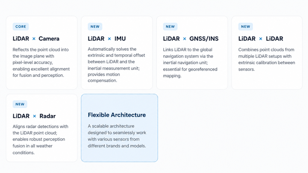
AutoFusion now automatically calibrates not only LiDAR-Camera, but also LiDAR-IMU, LiDAR-GNSS/INS, LiDAR-LiDAR, and LiDAR-Radar combinations without requiring calibration targets.
Supported Calibrations
One Platform, Every Sensor Pair
AutoFusion’s flexible algorithm architecture aligns different modalities within a common reference frame. It requires no calibration targets or environment preparation.
Sensor & Calibration (3B)
Automatically Solves Inter-Sensor Geometry
AutoFusion uses AI-powered algorithms to estimate 6-DoF extrinsic transformations (translation + roll/pitch/yaw) and time offsets between LiDAR, IMU, and GNSS/INS units from a short data recording.
- Calculates IMU → LiDAR and GNSS → IMU extrinsics in a single pass
- Works exclusively with dynamic (moving) data
- Requires no calibration targets, checkerboards, or site preparation
LiDAR-Camera Projection
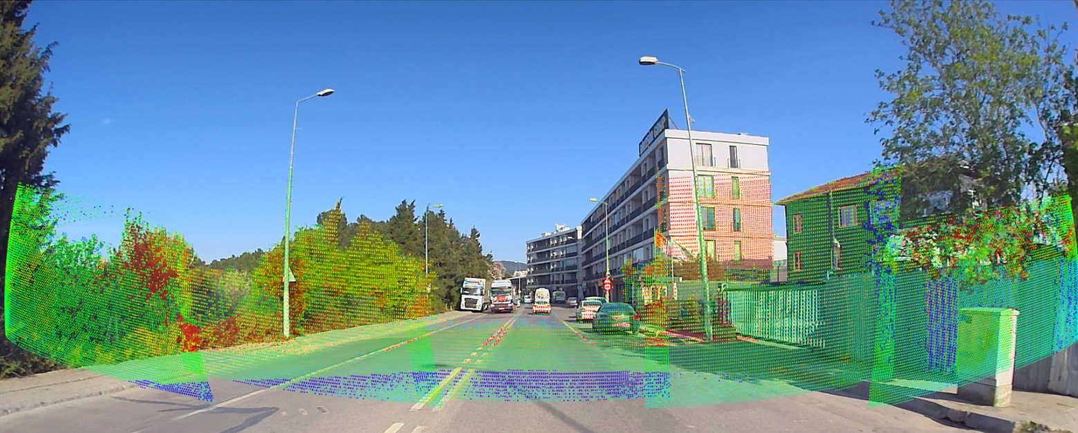
Projects the Point Cloud onto the Image with Pixel-Level Accuracy
The calibration result is validated instantly: the colorized LiDAR point cloud is precisely overlaid onto the camera image. Edges, surfaces, and depth transitions align seamlessly.
- Sub-pixel reprojection error
- Compatible with all LiDAR-camera pairs
- Real-time validation with live camera and LiDAR views
Technical Data
Key Highlight
Key Features
- Advanced algorithms and AI-powered high-precision sensor fusion
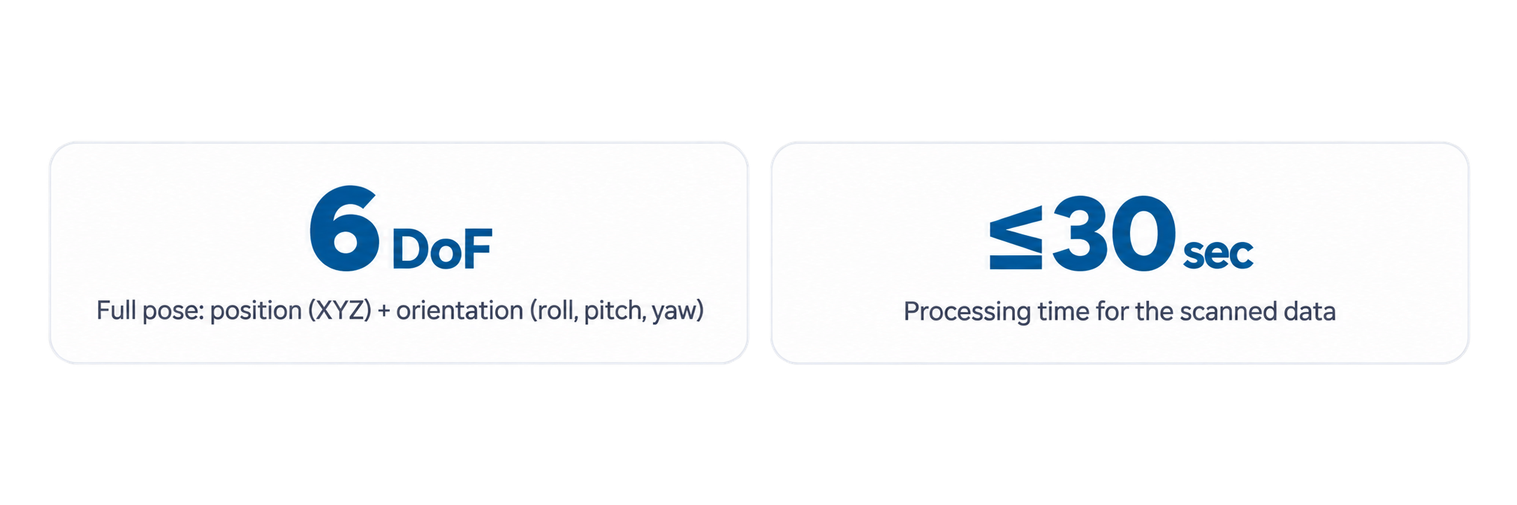
- 6-axis measurement capability: Position (XYZ) + orientation (roll, pitch, yaw)
- LiDAR-Camera, LiDAR-IMU, LiDAR-GNSS/INS, LiDAR-LiDAR, and LiDAR-Radar calibration
- Flexible architecture compatible with different brands and models
- Processes collected data in no more than 30 minutes
- Works with dynamic (moving) data
- Easy data collection thanks to its targetless architecture
Functional Benefits
- High-Speed Processing — short data recording, processing in no more than 30 minutes
- High Accuracy — sub-pixel reprojection, 6-DoF accuracy
- Broad Applicability — LiDAR, camera, IMU, GNSS/INS, radar
- User-Friendly — easy to use with no calibration targets or site preparation required
- 6-Axis Measurement Capability — position and orientation combined
- No Hardware Time Synchronization Required — PTP/PPS is not required; AutoFusion automatically estimates the time offset between sensors
Application Areas
Where Is It Used?